Holdsworth - Kaitoke Track
DOC track · Wairarapa
Holdsworth - Kaitoke Track is a 36.0 km DOC tramping track in Wairarapa with 1,486 m of climbing and a high point of 758 m.
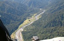
This is one of the classic tramps of the Tararua Forest Park. It follows the Waiohine and Tauwharenīkau rivers between Holdsworth and Kaitoke.
Track stats
| Distance | 36.0 km |
|---|---|
| Time (DOC) | 2-3 days |
| Difficulty (DOC) | Advanced |
| Track type | Easy Tramping Track |
| Elevation gain | 1,486 m |
| Elevation loss | 1,094 m |
| Highest point | 758 m |
| Lowest point | 143 m |
| Region | Wairarapa |
| Start | -41.06981, 175.22803 |
| End | -40.90234, 175.43979 |
Distance, elevation and the profile are worked out by TrailTreks from DOC's track line and the LINZ 8 m elevation model, from the start marker on the map. Time and difficulty are DOC's.
Elevation profile
Huts near the track
- Cone Hut (on the track)
- Tutuwai Hut (on the track)
- Totara Flats Hut (0.1 km from the track)
- Sayer Hut (0.2 km from the track)
Campsites near the track
- Waiohine Gorge Campsite (0.2 km from the track)
GPX file
Download the Holdsworth - Kaitoke Track GPX file (DOC's full track line with elevations) for your GPS or mapping app.
Alerts and conditions
Check current alerts on DOC before you go: tracks close for slips, floods, fire risk and pest control. The DOC page also has access, facilities and safety information.
Nearby DOC tracks
- Dobson Loop Track (0.0 km away)
- Renata-Alpha Crossing (0.9 km away)
- Smith Creek - Tauwharenīkau River (4.5 km away)
- Remutaka Rail Trail (10.9 km away)
- Cone Ridge Tracks (14.6 km away)
Plan it offline in TrailTreks
Plan Holdsworth - Kaitoke Track in the free TrailTreks: NZ Topo Maps app: LINZ topo maps that work with no signal, DOC huts, tracks and alerts, and mountain weather.