Caples/Greenstone track
Walked
Caples/Greenstone track is a 60.2 km tramp in Otago with 2,315 m of climbing and a high point of 991 m.
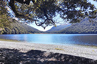
Track stats
| Distance | 60.2 km |
|---|---|
| Elevation gain | 2,315 m |
| Elevation loss | 2,316 m |
| Highest point | 991 m |
| Lowest point | 338 m |
| Time taken | 4 days |
| Region | Otago |
| Start | -44.93499, 168.34482 |
| End | -44.93499, 168.34482 |
Elevation profile
GPX file
Download the Caples/Greenstone track GPX file for your GPS or mapping app. The map on this page shows the same route.
Nearby tracks
- Eanslaw burn (22.4 km away)
- North Col - Lake Nerine - Park Pass - Sugarloaf Pass (24.7 km away)
- Routeburn Track (24.7 km away)
- 5 Passes Mt Aspiring (24.8 km away)
Open in TrailTreks
Take this track offline with the free TrailTreks: NZ Topo Maps app: LINZ topo maps that work with no signal, DOC huts and alerts, and mountain weather.